By Miles Layton
The nor’easter parked off the coast this week didn’t just hammer the Outer Banks — it pushed water into low-lying spots all across northeastern North Carolina.
Thursday, when I made the rounds through Hyde, Tyrrell and Washington counties, conditions there were rougher than what I saw in Chowan and Perquimans counties. Creeks are up, and there’s no denying that the wind is howling. While I was in the Hyde County Courthouse, I could hear it blowing hard outside. Driving through Fairfield and Swan Quarter, the low areas and drainage channels were close to spilling over. I wonder where the alligators go to ride out a storm when the culverts and canals are running like that.
Friday, the wind didn’t let up much, and the Albemarle Sound itself was a mess.
Out on Ocracoke, folks weren’t too worried at first. The island gets wet during nor’easters — that’s nothing new. But this storm has brought more than the usual soaking.
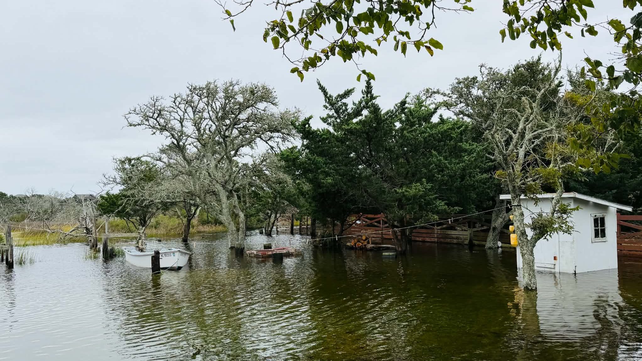
Note — check out how the boat in these photos moved!


Ocracoke resident Kelley Shinn — who took these photos — said the water on her property was a couple of inches higher Friday than it had been the day before — a couple of feet deep in the worst spots. It carried off her kayaks, filled up a pool that wasn’t supposed to have water in it, and swept away a woodpile stacked with heavy logs. The one thing spared was an old pickup truck, parked up on her dad’s old car ramps at the highest point of the front yard.
“This is a large inconvenience for us, not without a lot of potential for dangerous situations,” Shinn said. She’s also worried about what the saltwater means for everyone’s gardens and fig trees, which for many families on the island supply a good chunk of their annual income and now stand to be lost to salt burn.
But Shinn said the real trouble is Highway 12 breaking up at Pea Island — and what happens after. With that stretch impassable, all of Hatteras traffic will have to route through Ocracoke once the ferries start running again. Those ferries are already booked solid with tourist reservations through at least Wednesday, she said, since no state of emergency was ever declared. Meanwhile, plenty of visitors are still on the island, driving their vehicles through saltwater floodwater anyway.
“I’m pretty weathered. I’m fine,” Shinn said. “Plus, the peanut butter pie (she made) is fabulous.”
As of Friay morning, Highway 12 is closed in several spots, cutting off the normal way in and out of Outer Banks communities. The worst of it is between the Marc Basnight Bridge and Rodanthe, where the dunes gave way and ocean water poured across the road, tearing up the pavement. Ocracoke Island has its own closure between the Park Service pony pens and the ferry terminal, also from overwash. Down in Hatteras Village, sound-side flooding is running one to six inches deep between Eagle Pass and the ferry terminal.
Nobody’s saying when the road will reopen. NCDOT says conditions could get worse with each high tide, and they’re pointing folks to DriveNC.gov for the latest. We’ll keep you updated when we hear something.
Offshore, it’s just as ugly — winds, rough surf, and waves over 15 feet have been reported, along with serious beach erosion and rip currents strong enough to be life-threatening. Most ferry runs to and from Ocracoke are suspended too, so for now, there’s not much of a way on or off some of these islands besides waiting the storm out.
On a related note, high tide and the same nor’easter sent water into Tangier, Virginia, the barrier island out in the middle of the Chesapeake Bay. Mayor Ooker Eskridge’s front porch got a little wet as water ran across his front yard, and the Bay itself is a mess. Still, that beats living in the West Virginia mountains or the hills of Southeast Ohio, where flooding has been even worse this week.
If you’re in the area, coastal or inland, keep an eye on local emergency alerts and stay off the roads unless you have to be out.
There’s relief in sight, though. After days of wind and rain, northeastern North Carolina is set to dry out this weekend, with clearing skies and a taste of fall arriving Friday and Saturday. Friday starts out mostly cloudy with a slim chance of a lingering morning shower before skies clear through the day and highs reach the low to mid-70s. Once those clouds clear out Friday night, temperatures will drop into the upper 40s to low 50s — some of the coolest overnight lows the region has seen in months.
Saturday looks even better: sunny, pleasant, and a lot more fall-like, with highs climbing into the mid-to-upper 70s and possibly touching 80°F in spots. Saturday night stays clear and calm, with lows settling around 52°F to 55°F.
It’ll be a welcome break for a region that just weathered a rough few days of wind, flooding and washed-out roads.
Let us know what you think by leaving a comment. Comments are subject to approval.